
Explaining Max Fisher’s Missing Maps
By Yousef Munayyer
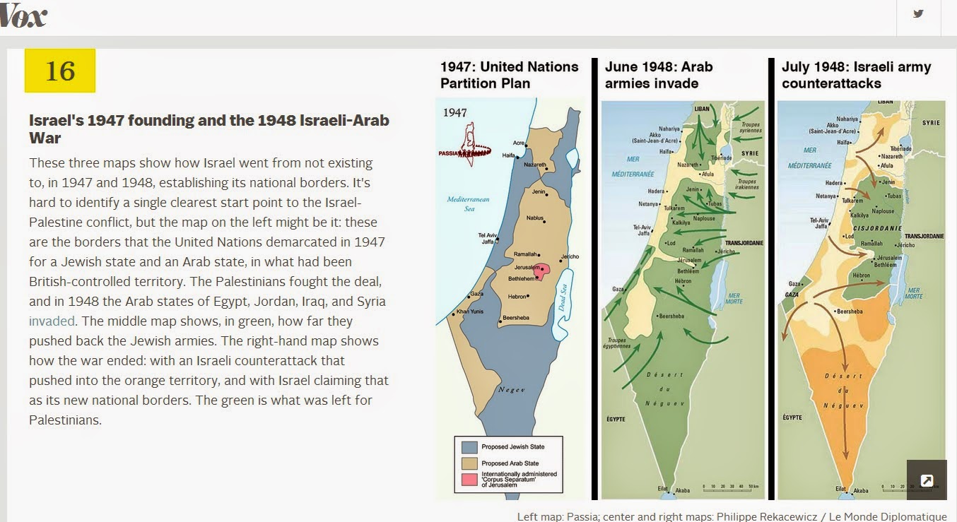
Over at Vox, blogger Max Fisher has a post up entitled “40 Maps That Explain the Middle East.” If such a title makes you cringe, you are not alone. Often these types of posts which attempt to provide context do more to obscure reality and explain the creator’s biases more than anything else. I am not going to dwell on each map. I won’t claim to know enough about the nuanced political and historical geography in every one of these maps to offer a detailed critique here. However, one thing I do know very well is the nuanced political and historical geography of Palestine and particularly the events around the Nakba. These events are supposedly represented by map number 16 on Max’s “explanatory” list entitled “Israel’s 1947 founding and the 1948 Israeli-Arab War.”